September 29, 2012

Day 16 - September 29, 2012: The run on down to the Ohio River turnoff

This would be our longest day so far as we had to go 100 miles to get to the Ohio anchorage at Angelo's Toe Head. On the way we passed Tower Rock. This rock is an unusual landmark of great size not to be missed. It was noted by Jolliet and Marquette in their journals as they explored the Mississippi in 1673.

Tower Rock Landmark
As we approached the Ohio River the Mississippi actually goes north around a loop and then back south where they join together. This is a chart plotter image of the intersection. This is a staging point for tows north and south bound on both rivers. Each of the pointed arrow heads (no tails) represent a tow. There are seventeen in this shot and I noted 25 at one point! This means you have to pay attention at all times or else...

Major Tow traffic approaching the junction with the Ohio River
You can see this junction just past the bridge below. Here we are at anchor at Angelo's Toe Head just safely out of the channel. Missouri is on the right, Illinois on the left, and Kentucky in the distance.

Junction of the Ohio River just beyond the bridge
I just can't resist showing these...

Day 15 - September 28, 2012: The wing dam anchorage at mile 102

This mile 102 anchorage is reported by Hoppies as one of two that are possible between there and the Ohio River (158 mi).  So we started out early in case it didn't work and we needed to go on. We met Joel and Debby in a beautiful blue hull Fathom 40 the night before and decided to cruise together.  On arrival we did find plenty of depth and managed to fit our two boats plus 3 sailboats and had room for at least 3 more. Success!

Fathom 40 named Water Music
Anchored with bow/stern anchors


Here is the view we had out over the rock wing dam. The tows continued to go by most of the night but never bothered us.

View from the roof deck out over the wing dam
Having arrived early we had some time to relax and play. I rowed the dinghy for exercise, motored her out into the river, and got some sun on the roof deck.

September 28, 2012

Day 14 - September 27, 2012: A Disappointment in St. Louis

We left Alton early to get to Hoppies which is the last marina with fuel on the Mississippi before we turn up the Ohio River. This is no problem for us as we have only used about 1/3 of a tank on the entire trip so far! I love the American Tug because, although we were going with the current, I was getting up to 10 mpg.

It was overcast and rainy, and we passed through St. Louis with great disappointment. Fortunately, we have visited here before and toured the city and the Arch. On the other hand, this picture is unique in its own way. How many others can show just 1/3 of the Arch shrouded in fog to their friends?

The Gateway Arch in St. Louis
Fern Hopkins, the owner of Hoppie's Marina, is famous for giving a briefing daily at 4:30 to loopers who are concerned about the long next leg either because of fuel or the need to locate a suitable anchorage. Since the Mississippi is very low, most of the anchorages are silted in and unusable. Despite years on the river, she was really hard-pressed to give us much hope. We were fortunate to have found a blog of a couple traveling with 4 boats just ahead of us and got a good tip on a location behind a wing dam.

Hoppies Marina - Quaint but you get fuel and good advice
A wing dam is a rock and sand pier that sticks out into the river from one side or the other and serves to slow the current near the edge and divert the water into the main channel. This increases the velocity of the water in the main channel and helps keep it deeper so the tows can get through. Unfortunately, it also causes increased silting in the side channels and bayous off the main channel reducing the depth of the entrance and keeping pleasure craft from using them as anchorages.

September 26, 2012

Day 13 - The Upper Mississippi River: September 26, 2012

What can I say about the Mighty Mississippi? We don't give it much thought in our daily lives, but this river has had and continues to have a monumental influence on our country's evolution, our economic prosperity, and our citizen's daily lives. I'm sure I could write a book or two (Mark Twain did) about what I will learn traveling this river over the next few days. We departed Grafton early and passed the confluence of the Illinois and Upper Mississippi Rivers.

Upper Mississippi on the left and Illinois on the right come together 
The Mississippi is the third longest river in the world, drains a basin from Idaho to New York and Canada to Mexico (over 40% of the U.S.), and represents the boundary between east and west. It was shaped by the glaciers, still has fish evolved from those found in prehistoric oceans, was settled gradually upstream from New Orleans during the founding of our country, and played a significant role in the Civil War.

This river is subject to flooding and the greatest flood of 1993 saw the river rise as much as 38 ft in places, killing over 50 people and displacing tens of thousands of people. Harnessing the river is the responsibility of the Army Corps of Engineers and has lead to the building of 27 locks and dams with the most recent in 1994 costing $1B.

A staggering 1/3 of all river freight in the U.S. moves on the Mississippi. A typical upper Mississippi tow is 15 barges, each 200 ft long. Barges carry wheat to New Orleans for export, oil for refining, and coal for power plants, and a single barge of wheat can make almost a million loaves of bread. The river is a resource for fishing, boating, and tourism which supports the cities along the river. In the 1800s, riverboats transported people up and down the river, which allowed the emerging New Orleans jazz to mix with Nashville's country music. In the 1800s, river boats transported people up and down the river, which allowed the emerging New Orleans jazz to mix with Nashville's country music.

A restored 1800s steam powered river boat
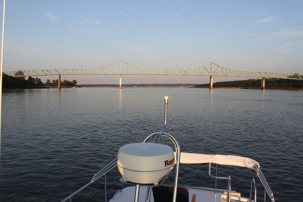
We stayed in Alton, Illinois after passing under the Clark Highway Bridge. Built in 1994, it is a stunning engineering marvel with a roadbed suspended from pillars 283 ft high with 160 miles of cable. Each cable is wrapped in golden-yellow plastic so in the evening they glow in the sun.

Clark Highway Bridge
We walked to visit the National Great River Museum at the Melvin E. Price Lock and Dam and toured the massive structure. Tomorrow we will go through the smaller of the two locks (600 ft. vs 1200 ft.) on our way to St. Louis. We will be anchoring out in a remote area south of St. Louis and may not be in contact for 2 to 3 days.

September 25, 2012

Days 10 - 12, September 23 - 25: The Illinois River to the Junction of the Mississippi River

This is the most remote river area we have traveled through. There are a few small towns, few marinas, and little or no cell phone or internet service. The river bank has looked the same throughout this area with only one riverbank home seen in two days. The tows are becoming more frequent as we near the Mississippi River. This one is 130 ft long and has liveaboard crews that run from New Orleans to Chicago 24 hrs a day.

Typical river banks
A large river tug


Today we decided to try our first anchoring on the river. Good anchorages are inlets off the river or behind small islands as they provide protection from wind and the wakes of the tows. Since the river levels this year are very low, many of the anchorages are too shallow to get into. Our first attempt was at Grape Towhead Island just south of Beardstown; however, the boat grounded trying to get in, and I was lucky to be able to back it off. We found a better one nearby just southwest of Bar Island and it turned out to be a beautiful spot. You can see the same location on the chart plotter with our boat position identified by the GPS (quite remarkable accuracy) and a depth of 8.4 ft. The sunset was just spectacular and was the highlight of the day.

Anchorage off Bar Island
Anchorage off Bar Island on the chart plotter
Sunset at Bar Island Anchorage
The next day we passed the westerly most point on the Great Loop which is the Valley City dual railroad bridge. We ended up tying up for the night at the Illinois River Dock Restaurant where we got a discount if we purchased dinner (it was a great brisket and too much to eat). We continue to meet interesting people all along the way who are also looping.

Tonight we are tucked in at Grafton Marina which is at the confluence of the Illinois and Mississippi Rivers. Tomorrow we change rivers and head for St. Louis.

September 23, 2012

Day 9 - September 21, 2012: Peoria to Havana, Ill

We awoke to sunshine and readied for an early start. A northwest tail wind would give us a helpful push.

Illinois Valley Yacht Club (Ivy)
Peoria is the largest city on the river between Chicago and St. Louis. It is home to Caterpillar and Maui Jim (formerly in Hawaii). We didn't stop here as you really need a car to get around. 

Peoria, Ill
The river is an important mode of transportation, and we encountered a number of barges today. They refer to them as "tows"; however, the barges are not really being towed but pushed by tugs. The more barges you can push with a single tug, the more money you can make on a single run. We encountered this one with 15 barges. They are so long and wide that when rounding a curve, they may touch both banks simultaneously. The rule is you must call the tug captain and ask which side he wants you to pass on so you won't get squished like a bug. It is also wise to stay out of the tug wake as the 12,000 HP engines and large props can push a lot of swirling water.

Don't argue with this!
We all know about the threat of the Asian Carp to the Great Lakes. They have come up the Mississippi and are working their way up the Illinois River and have been spotted as close as 40 miles from Chicago. We began to see them in significant numbers today. They seem to like to jump in the agitated wake water behind the boat, and one jumped into a fellow boater's dinghy. When we got to our destination which was Tall Timbers Marina in Havana, Ill, one jumped up on the dock while we were standing there. Here is our first close up look.

Silver Asian Carp
Later we grilled salmon and settled in to listen to the Michigan vs Notre Dame football game. If you are a UofM fan, you already know the result.

Tall Timbers Marina, Havana, Ill

September 22, 2012

Day 8 - September 21: More on the Illinois River

The Illinois River winds through farm lands and rural cities and is controlled by dams and locks every 20 or 30 miles. The locks are gradually lowering us from Lake MI, which is about 580 ft in elevation, to sea level in Mobile, Al. There is not much grandiose scenery nor are there nationally famous parks or cities. Just relatively flat rich soil and farmland. If the Illinois River were in Southern California, there would be homes along every inch of the way!

Tree-lined banks
For my model railroad friends (Alden and Kurt)
The American White Pelicans are currently migrating south from the Great Lakes and Canada. They are one of the world's largest birds, weighing up to 30 lbs and having wingspans that can reach 110 in. Unlike the Brown Pelicans, they have a black-edged wing that is visible in flight.

A pelican convention
Pelicans in flight
Our destination was the Illinois Valley Yacht Club 4 mi north of Peoria, Ill. It is a longtime sailing club and marina with a very stately clubhouse, bar and 4-star restaurant. It was cold, rainy and cloudy but we had a great meal and met club members who have also done the loop.

September 21, 2012

Day 7 - September 20, 2012: A day to catch up

We liked Heritage Harbor so well, we stayed another day to restock, clean up the boat, and relax.

Sometimes you are struck by strange coincidences:
     1. Heritage Harbor is located in Ottawa, Ill., and we live in Ottawa County, MI.
     2. We found ourselves in a marina with 2 other loopers, both of whom have stored their boats in the same Spring Lake marina we did.
What are the odds of that?

Ottawa, Ill is best known as the site of one of the Lincoln/Douglas debates. They have a statue of the two debating in the park, and if it is true to scale, Lincoln was at least 2 ft taller than Douglas!

Anne makes a great salad for lunch. Note she grows fresh herbs, has an HDTV giving her the latest news, and an Ipad to give her new recipes.

Chef Anne 

September 20, 2012

Day 6 - On the Illinois River: September 19, 2012

The river has its own personality from morning to night. We woke to sunrise and a steam over the water.

Harborside Marina
Marina docks
We are getting more confident in the locks. After the doors open and there is a green light, we motor in and slip a line from the center of the tug to a bollard built into the lock wall. This bollard floats down with the boat. Here Anne is holding our 20,000 lb tug to the bollard with ease. A typical drop here is 30-40 ft per lock.


Arriving at Heritage Harbor Marina mid-afternoon, we were surprised to find a 5-star facility with modern floating docks, a restaurant, a pool, and a brand new car with only 600 miles that they let us use at no cost.

Heritage Harbor Marina
Great Laker at rest

September 18, 2012

Day 5 - The Chicago Sanitary Ship Canal: September 18, 2012

Our first of 115 locks to come! How can one express the excitement? Anne was quite nervous and came through with flying colors by setting the fenders, donning gloves, and holding us fast to the line hanging from the starboard wall. While we dropped only 3 ft, this was a good warm-up for more to come.

Entering the Chicago Harbor Lock

As we passed under the 49 bridges in the Chicago area, many people waved to us. Why is it that we get waves from people we don't know while on a boat in the river? No one waves at us from the sidewalk when we drive by on the street. I'm sure they don't recognize us, don't think we are celebrities, and never expect to see us again. Maybe they are expressing appreciation for what we are doing that they would like to do as well?

After two more locks, one 39 ft down and one 34 ft down, we passed Joliet and chose to stay at the Harborside Marina.

Day 4 - More Chicago Sightseeing: September 17, 2012

The Chicago Institute for the Arts, sushi for lunch, and a relaxing afternoon on Great Laker.

September 16, 2012

Day 3 - Chicago: September 16, 2012

What a fabulous early morning view from Great Laker!

Morning coffee on the sun deck
We walked the Navy Pier and then took the highly recommended Chicago Architecture Foundation River Cruise. There are dozens of buildings with creative and differing architectures built over the last 100 years.

Entrance to Illinois River
Sears Tower


Trump Tower

Cityfront Place


Day 2 - Crossing Lake MI: Sept 15, 2012

After a night in St. Joseph, which by the way has a wonderful old downtown with great shops and restaurants right on the lake, we left to cross Lake MI to Chicago.

When you mention cruising on the Great Lakes to Loopers (who are mostly from other areas) they have a somewhat negative reaction. They have heard of the waves and weather that can churn up the lake to intolerable levels and cause weather delays in boating travel. This fear does have some justification as there are an estimated 6,000 to 10,000 shipwrecks lying on the floor of the Great Lakes, and some of these are major freighters or ocean going vessels.  No one likes to get out offshore and unexpectedly get buffeted by 4-6 or 5-7 ft. waves (especially Admiral Anne).

We started with a forecast of 1-3 ft. waves, settling down to 1 ft. or less, and were fortunate that the forecast came true. The crossing was sunny and pleasant as we approached the famous Chicago skyline. We docked at the Columbia Yacht Club which is a short walking distance from the heart of Chicago.

First sighting
Me, too
The skyline is dramatic and very captivating.  

Chicago Sears and Trump Towers are the tallest

September 14, 2012

Day 1 - Heading out on the Great Loop!

After 2 1/2 years of planning and preparing, today we departed on our dream adventure. We left our home on Spring Lake, took the Grand River through Grand Haven, and turned south toward St. Joseph. 


Packed, warming up the engine, and ready to go from our home in Spring Lake
Bon Voyage (thanks Dave for the pictures)
Turning south at the Grand Haven Lighthouse toward St. Joseph
We plan to cross our wake here when returning next summer